Neighborhood Assessment
Neighborhood Assessment Completed
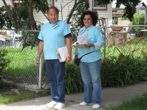
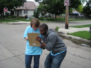
On Monday, June 2, 2008 a team of individuals ranging in age from 18 to 65 assembled at a central location in Detroit and began their first day of data collection for the Detroit Neighborhood Health Study (DNHS). This team was comprised of 20 people who were mostly residents of Detroit as well as several undergraduate and graduate students from the University of Michigan. All had gone through a full day of training in order to prepare for this task.
The data collectors were armed with clipboards and assessment checklists that asked about factors that contribute to health outcomes such as cleanliness, the condition of streets, sidewalks and buildings, traffic and noise levels, and indicators of investment or disinvestment in the community. The team walked several blocks in a cluster of streets known as a block group (see below for a description), and then continued on to another neighborhood to do the same. This process was repeated morning and afternoon, five days per week until July 2nd when all of the randomly selected block groups in each of Detroit’s 54 neighborhoods had been assessed for the study. On completion of the data collection the team was treated to a celebratory lunch during which many anecdotal experiences were shared.
Photos of the data collection team on training day and in the field appear on this page.
Data entry for this phase of the study was completed in August 2008 and data analysis continues. Preliminary results can be seen by clicking on the Home page of this website and then clicking on Presentation #1 at the bottom of the page.
Block Group Selection
For the Neighborhood Assessment part of this study described above, we wanted to get a picture of participants’ neighborhoods so that we might evaluate how neighborhood characteristics influence their health. Because neighborhoods are large, we decided to evaluate smaller areas within these neighborhoods. Neighborhoods are made up of census tracts, and census tracts are made up of block groups. Block groups are combinations of adjacent blocks within a geographic area described by the U.S. Census. We therefore used block groups to represent the neighborhoods in which they are located. We selected block groups for evaluation in such a way that neighborhoods with different types of physical environments were all represented in our sample. We decided on how many block groups to randomly sample based on how many people live in that neighborhood and how many people live within a certain size area (using data from the 2000 Census). We chose a total of 138 block groups; at least one block group was chosen from each of Detroit’s 54 neighborhoods.
Additional Photos
Assessing the Neighborhood
Checking Assessments

Checking Route Maps

Data Collectors After Last Day Lunch
Detroit Neighborhood Park
Detroit Neighborhood Superfund Site